Keywords
Theme:
directionals, boreholes, wells, Earth Science Associates, GOMsmart, GOM3, GOM-Cubed
Place:
Gulf of Mexico, GOM, USA
Stratum:
Offshore
Temporal:
1947 to Present
Description
Abstract
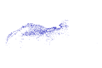
Directional surveys are the measurements of inclination and azimuth throughout the well. Most directional surveys in the Gulf have measurements at 100 foot intervals. The latitude and longitude is also given at each measurement point. All surveys are referenced to grid north in the native map projection of the block containing the surface location of the survey. For some old surveys the north reference was not marked and was assumed by BOEM to be grid north. They are mapped as full 3D lines for use in maps and 3D scenes.
Purpose
Analysis for oil and gas exploration and production in the Gulf of Mexico.
_________________
Status of the data
Complete. Directional surveys are available on 98.5% of non-straight hole, eligble wells (drilling finished over 26 months ago).
Data update frequency: Monthly
Data update frequency: Monthly
Description:
publication date
Publication Information
Who created the data:
BOEM, Earth Science Associates
Series name:
BOEM Website/BOEM Atlas Series/Public Sources
_________________
Data storage and access information
File name:
direct
Type of data: vector digital data
http://www.boem.gov
Data processing environment:
Microsoft Windows XP Version 5.1 (Build 2600) Service Pack 3; ESRI ArcGIS 9.2.0.1324
Type of data: vector digital data
Location of the data:
Size of the data:
175.76 MB
Data transfer size: 175.76 MB
Data transfer size: 175.76 MB
Constraints on accessing and using the data
Access constraints:
Licensed GOM-Cubed Users
Use constraints:
License Terms under GOM-Cubed license agreement
Details about this document
Who completed this document
DBA
Earth Science Associates
mailing and physical address:
(562) 428-3181 (voice)
contactesa@earthsci.com
Earth Science Associates
mailing and physical address:
4300 Long Beach Blvd., Suite 310
Long Beach, CA 90807
USA
(562) 428-3181 (voice)
contactesa@earthsci.com
Hours of service:
9-6 Pacific Time (Monday - Friday)
Standards used to create this document
Standard name:
FGDC Content Standards for Digital Geospatial Metadata
Standard version: FGDC-STD-001-1998
Time convention used in this document: local time
Metadata profiles defining additonal information
ESRI Metadata Profile:
http://www.esri.com/metadata/esriprof80.html
Standard version: FGDC-STD-001-1998
Time convention used in this document: local time
Metadata profiles defining additonal information
Horizontal coordinate system
Geographic coordinate system name:
GCS_North_American_1927
Details
Geographic Coordinate System
Latitude Resolution:
0.000000
Longitude Resolution:
0.000000
Geographic Coordinate Units:
Decimal degrees
Geodetic Model
Horizontal Datum Name:
North American Datum of 1927
Ellipsoid Name:
Clarke 1866
Semi-major Axis:
6378206.400000
Denominator of Flattening Ratio:
294.978698
Altitude System Definition
Resolution:
0.000000
Encoding Method:
Explicit elevation coordinate included with horizontal coordinates
Depth System Definition
Datum Name:
Mean sea level
Distance Units:
feet
Encoding Method:
Attribute values
_________________
Bounding coordinates
Horizontal
In decimal degrees
West:
-97.2029017
East:
-83.3982465
North:
30.1965587
South:
25.999996
In projected or local coordinates
Left:
-97.2029017
Right:
-83.3982465
Top:
25.999996
Bottom:
30.1965587
Vertical
Minimum elevation:
-29680
Maximum elevation:
-199
_________________
Lineage
FGDC lineage
Process step 1
Process description:
The Directional Survey Lat/Lon pairs and TVD were run through ArcGIS to create polylines.
Who did this process
DBA
Earth Science Associates
mailing and physical address:
(562) 428-3181 (voice)
contactesa@earthsci.com
Earth Science Associates
mailing and physical address:
4300 Long Beach Blvd., Suite 310
Long Beach, CA 90807
USA
(562) 428-3181 (voice)
contactesa@earthsci.com
Hours of service:
9-6 Pacific Time (Monday - Friday)
Process step 2
Process description:
ESA downloaded the original file from BOEM. The data were then cleaned and formatted. A new mdb was generated and a shapefile created.
Process step 3
Process description:
Dataset copied.
Source used: F:\Backup\Metadata_xmls\Patrick\XMLs_incomplete\direct.shp
Source used: F:\Backup\Metadata_xmls\Patrick\XMLs_incomplete\direct.shp
_________________
Spatial data quality
Horizontal positional accuracy
BOEM data checked for obvious errors in entry. ESA calculated values checked for quality.
Vertical positional accuracy
BOEM data checked for obvious errors in entry. ESA calculated values checked for quality.
_________________
Spatial data description
Vector data information
ESRI description
direct
ESRI feature type:
Simple
Geometry type: Polyline
Topology: FALSE
Spatial Index: TRUE
Linear referencing: TRUE
Geometry type: Polyline
Topology: FALSE
Spatial Index: TRUE
Linear referencing: TRUE
SDTS description
direct:
String
Feature class: SDTS feature type, feature count
Details for direct
Type of object:
Feature Class
Attributes
FID
Alias:
FID
Data type: OID
Width: 4
Precision: 0
Scale: 0
Definition: Internal feature number. Definition Source: ESRI
Data type: OID
Width: 4
Precision: 0
Scale: 0
Definition: Internal feature number. Definition Source: ESRI
Shape
Alias:
Shape
Data type: Geometry
Width: 0
Precision: 0
Scale: 0
Definition: Feature geometry. Definition Source: ESRI
Data type: Geometry
Width: 0
Precision: 0
Scale: 0
Definition: Feature geometry. Definition Source: ESRI
APINUM
Alias:
API Number
Data type: String
Width: 12
Definition: API_WELL_NUMBER -A unique well identification number consisting of (from left to right) a two digit state code (or pseudo for Offshore), a three digit county code (or pseudo for Offshore), a five digit unique well code, and if applicable, a two digit sidetrack code as defined in API Bulletin D12A. Definition Source: https://www.data.boem.gov/Main/HtmlPage.aspx?page=borehole
WELLNAME
Alias:
Well Name
Data type: String
Width: 6
Definition: WELL_NAME - The name assigned to the well. It may be a special name or the name of the property to which the well belongs. Definition Source: https://www.data.boem.gov/Main/HtmlPage.aspx?page=borehole
Data type: String
Width: 6
Definition: WELL_NAME - The name assigned to the well. It may be a special name or the name of the property to which the well belongs. Definition Source: https://www.data.boem.gov/Main/HtmlPage.aspx?page=borehole
WELLSUFFIX
Alias:
Well Name Suffix
Data type: String
Width: 8
Definition: WELL_NAME_SUFFIX - An extension to the well name that indicates the number of times that a new wellbore has been drilled. Definition Source: https://www.data.boem.gov/Main/HtmlPage.aspx?page=borehole
Data type: String
Width: 8
Definition: WELL_NAME_SUFFIX - An extension to the well name that indicates the number of times that a new wellbore has been drilled. Definition Source: https://www.data.boem.gov/Main/HtmlPage.aspx?page=borehole
OPERNUM
Alias:
Well Operator Code
Data type: String
Width: 5
Definition: MMS_COMPANY_NUM - The number assigned by the https://www.data.boem.gov/Main/HtmlPage.aspx?page=boreholeRE (formerly MMS) to a business entity, individual, or agency with whom the https://www.data.boem.gov/Main/HtmlPage.aspx?page=boreholeRE/MMS does business or exchanges information. Definition Source: https://www.data.boem.gov/Main/HtmlPage.aspx?page=borehole
FABBRV
Alias:
Field Abbreviation
Data type: String
Width: 8
Definition: Field abbreviation
Data type: String
Width: 8
Definition: Field abbreviation
SPUDDATE
Alias:
Well Spud Date
Data type: Number
Width: 9
Definition: WELL_SPUD_DATE - The date that the drilling rig first begins boring into the earth's surface. Definition Source: https://www.data.boem.gov/Main/HtmlPage.aspx?page=borehole
Data type: Number
Width: 9
Definition: WELL_SPUD_DATE - The date that the drilling rig first begins boring into the earth's surface. Definition Source: https://www.data.boem.gov/Main/HtmlPage.aspx?page=borehole
WBHLSENUM
Alias:
Well Bottom Hole Lease Number
Data type: String
Width: 10
Data type: String
Width: 10
WRKBELEV
Alias:
Rig Kelly Bushing Elevation (feet)
Data type: Number
Width: 9
Definition: RKB_ELEVATION - The distance from the rig's kelly bushing to mean sea level. Definition Source: https://www.data.boem.gov/Main/HtmlPage.aspx?page=borehole
Data type: Number
Width: 9
Definition: RKB_ELEVATION - The distance from the rig's kelly bushing to mean sea level. Definition Source: https://www.data.boem.gov/Main/HtmlPage.aspx?page=borehole
WBHMD
Alias:
Well Bottom Hole Measured Depth (feet)
Data type: Number
Width: 9
Definition: This field is derived from the expression... decode(bv.public_release_flag, 'Y', to_char(BV.bh_total_md), '*****') ...and consists of these database columns: Definition Source: https://www.data.boem.gov/Main/HtmlPage.aspx?page=borehole
Data type: Number
Width: 9
Definition: This field is derived from the expression... decode(bv.public_release_flag, 'Y', to_char(BV.bh_total_md), '*****') ...and consists of these database columns: Definition Source: https://www.data.boem.gov/Main/HtmlPage.aspx?page=borehole
WBHTVD
Alias:
Well Bottom Hole True Vertical Depth (feet)
Data type: Number
Width: 9
Definition: This field is derived from the expression... decode(bv.public_release_flag, 'Y', to_char(BV.well_bore_tvd), '*****') ...and consists of these database columns: Definition Source: https://www.data.boem.gov/Main/HtmlPage.aspx?page=borehole
Data type: Number
Width: 9
Definition: This field is derived from the expression... decode(bv.public_release_flag, 'Y', to_char(BV.well_bore_tvd), '*****') ...and consists of these database columns: Definition Source: https://www.data.boem.gov/Main/HtmlPage.aspx?page=borehole
WSRFNSDIST
Alias:
Well Surface North-South Distance
Data type: Number
Width: 9
Definition: N_S_DISTANCE - North/South footage or distance that represents the length of a measurement from an identifiable line. / The distance from the borehole surface location to either the north or south block boundary. Definition Source: https://www.data.boem.gov/Main/HtmlPage.aspx?page=borehole
WSRFNSF
Alias:
Well Surface North-South Code
Data type: String
Width: 1
Definition: N_S_CODE - North/South descriptor that indicates the direction of a measurement from an identifiable line. / Indicates whether the surface borehole location is measured from the north (N) or south (S) block boundary. Definition Source: https://www.data.boem.gov/Main/HtmlPage.aspx?page=borehole
WSRFEWDIST
Alias:
Well Surface East-West Distance
Data type: Number
Width: 9
Definition: E_W_DISTANCE - East_West footage or distance that represents the length of a measurement from an identifiable line./The distance from the borehole surface location to either the east or west block boundary. Definition Source: https://www.data.boem.gov/Main/HtmlPage.aspx?page=borehole
WSRFEWF
Alias:
Well Surface East-West Code
Data type: String
Width: 1
Definition: E_W_CODE - East/West descriptor that indicates the direction of a measurement from an identifiable line. / Indicates whether the surface borehole location is measured from either the east (E) or west (W) block boundary. Definition Source: https://www.data.boem.gov/Main/HtmlPage.aspx?page=borehole
WSRFAREACD
Alias:
Well Surface Area Code
Data type: String
Width: 3
Definition: AREA_CODE - The indicator used to identify an area name. Definition Source: https://www.data.boem.gov/Main/HtmlPage.aspx?page=borehole
Data type: String
Width: 3
Definition: AREA_CODE - The indicator used to identify an area name. Definition Source: https://www.data.boem.gov/Main/HtmlPage.aspx?page=borehole
WSRFBLKNUM
Alias:
Well Surface Block Number
Data type: String
Width: 5
Definition: BLOCK_NUMBER - Identifies a subdivision of an Official Protraction Diagram as applied to the subdivision containing the surface location of a well. Definition Source: https://www.data.boem.gov/Main/HtmlPage.aspx?page=borehole
Data type: String
Width: 5
Definition: BLOCK_NUMBER - Identifies a subdivision of an Official Protraction Diagram as applied to the subdivision containing the surface location of a well. Definition Source: https://www.data.boem.gov/Main/HtmlPage.aspx?page=borehole
WBOTNSDIST
Alias:
Well Bottom North-South Distance
Data type: Number
Width: 9
Definition: The distance from the borehole bottom location to either the North or South block boundary. Definition Source: https://www.data.boem.gov/Main/HtmlPage.aspx?page=borehole
Data type: Number
Width: 9
Definition: The distance from the borehole bottom location to either the North or South block boundary. Definition Source: https://www.data.boem.gov/Main/HtmlPage.aspx?page=borehole
WBOTNSF
Alias:
Well Bottom North-South Code
Data type: String
Width: 1
Definition: Indicates whether the borehole bottom location is measured from the North or South block boundary. Definition Source: https://www.data.boem.gov/Main/HtmlPage.aspx?page=borehole
Data type: String
Width: 1
Definition: Indicates whether the borehole bottom location is measured from the North or South block boundary. Definition Source: https://www.data.boem.gov/Main/HtmlPage.aspx?page=borehole
WBOTEWDIST
Alias:
Well Bottom East-West Distance
Data type: Number
Width: 9
Definition: The distance from the borhole bottom location to either the East or West block boundary. Definition Source: https://www.data.boem.gov/Main/HtmlPage.aspx?page=borehole
Data type: Number
Width: 9
Definition: The distance from the borhole bottom location to either the East or West block boundary. Definition Source: https://www.data.boem.gov/Main/HtmlPage.aspx?page=borehole
WBOTEWF
Alias:
Well Bottom East-West Code
Data type: String
Width: 1
Definition: Indicates whether the borehole bottom location is measured from the East or West block boundary. Definition Source: https://www.data.boem.gov/Main/HtmlPage.aspx?page=borehole
Data type: String
Width: 1
Definition: Indicates whether the borehole bottom location is measured from the East or West block boundary. Definition Source: https://www.data.boem.gov/Main/HtmlPage.aspx?page=borehole
WBOTAREACD
Alias:
Well Bottom Area Code
Data type: String
Width: 3
Definition: AREA_CODE - The designated abbreviation assigned to Outer Continental Shelf (OCS) geographical units for identification purposes and for use on maps and in data bases as applied to the bottomhole location of a well. Definition Source: https://www.data.boem.gov/Main/HtmlPage.aspx?page=borehole
WBOTBLKNUM
Alias:
Well Bottom Block Number
Data type: String
Width: 5
Definition: BLOCK_NUMBER - Identifies a subdivision of an Official Protraction Diagram as applied to the subdivision containing the bottomhole location of a well. Definition Source: http://www.data.https://www.data.boem.gov/Main/HtmlPage.aspx?page=borehole.gov/homepg/pubinfo/freeasci/well/zipped/fixed/DirSrvyPntsAPILISTFixeddfn.asphttps://www.data.boem.gov/Main/HtmlPage.aspx?page=borehole
WTDDT
Alias:
Well Total Depth Date
Data type: Number
Width: 9
Definition: TOTAL_DEPTH_DATE - The date drilling on a well reached the final total depth. The "2" in the field name indicates that a common date format has been used written as text. Definition Source: http://www.data.https://www.data.boem.gov/Main/HtmlPage.aspx?page=borehole.gov/homepg/pubinfo/freeasci/well/zipped/fixed/DirSrvyPntsAPILISTFixeddfn.asp
WSTATUSDT
Alias:
Well Status Date
Data type: Number
Width: 9
Definition: BOREHOLE_STAT_DT - The date the borehole status becomes effective. Definition Source: https://www.data.boem.gov/Main/HtmlPage.aspx?page=borehole
Data type: Number
Width: 9
Definition: BOREHOLE_STAT_DT - The date the borehole status becomes effective. Definition Source: https://www.data.boem.gov/Main/HtmlPage.aspx?page=borehole
WTYPECD
Alias:
Well Type Code
Data type: String
Width: 1
Definition: WELL_TYPE_CODE - Indicates the final classification of a borehole denoting the purpose of the drilling. Definition Source: https://www.data.boem.gov/Main/HtmlPage.aspx?page=borehole
Data type: String
Width: 1
Definition: WELL_TYPE_CODE - Indicates the final classification of a borehole denoting the purpose of the drilling. Definition Source: https://www.data.boem.gov/Main/HtmlPage.aspx?page=borehole
WDISTRICT
Alias:
Well District Code
Data type: String
Width: 2
Definition: Well District Code
Data type: String
Width: 2
Definition: Well District Code
WSTATUS
Alias:
Well Status Code
Data type: String
Width: 3
Definition: BOREHOLE_STAT_CD - Indicates the conditions relating to a borehole. E.g. "plugged and abandoned". Definition Source: https://www.data.boem.gov/Main/HtmlPage.aspx?page=borehole
Data type: String
Width: 3
Definition: BOREHOLE_STAT_CD - Indicates the conditions relating to a borehole. E.g. "plugged and abandoned". Definition Source: https://www.data.boem.gov/Main/HtmlPage.aspx?page=borehole
WATERDEPTH
Alias:
Water Depth (feet)
Data type: Number
Width: 9
Definition: WATER_DEPTH - The depth of the water at a well/platform location from the water level to the mud line. Definition Source: https://www.data.boem.gov/Main/HtmlPage.aspx?page=borehole
Data type: Number
Width: 9
Definition: WATER_DEPTH - The depth of the water at a well/platform location from the water level to the mud line. Definition Source: https://www.data.boem.gov/Main/HtmlPage.aspx?page=borehole
WSRFLON
Alias:
Well Surface Longitude
Data type: Float
Width: 19
Number of decimals: 11
Definition: The longitude value of a location in a borehole. A positive value denotes east. Angle measured about the spheroid axis from a local prime meridian to the meridian through the point. Definition Source: https://www.data.boem.gov/Main/HtmlPage.aspx?page=borehole
WSRFLAT
Alias:
Well Surface Latitude
Data type: Float
Width: 19
Number of decimals: 11
Definition: The latitude value of a location in the borehole. A positive value denotes north. Angle subtended with equatorial plane by a perpendicular from a point on the surface of a spheriod. Definition Source: https://www.data.boem.gov/Main/HtmlPage.aspx?page=borehole
WBOTLON
Alias:
Well Bottom Longitude
Data type: Float
Width: 19
Number of decimals: 11
Definition: This field is derived from the expression... decode(bv.public_release_flag, 'Y', to_char(BV.BOTM_LONGITUDE), '*****') ...and consists of these database columns: Definition Source: https://www.data.boem.gov/Main/HtmlPage.aspx?page=borehole
WBOTLAT
Alias:
Well Bottom Latitude
Data type: Float
Width: 19
Number of decimals: 11
Definition: The latitude value of a location in the borehole. A positive value denotes north. Angle subtended with equatorial plane by a perpendicular from a point on the surface of a spheriod. Definition Source: https://www.data.boem.gov/Main/HtmlPage.aspx?page=borehole
OPERATOR
Alias:
Operator
Data type: String
Width: 120
Definition: BUS_ASC_NAME -The name of the operator submitting the application. Definition Source: https://www.data.boem.gov/Main/HtmlPage.aspx?page=borehole
Data type: String
Width: 120
Definition: BUS_ASC_NAME -The name of the operator submitting the application. Definition Source: https://www.data.boem.gov/Main/HtmlPage.aspx?page=borehole
SRFAREABLK
Alias:
Well Surface Area + Block Number
Data type: String
Width: 6
Definition: Well Surface Area + Block Number Definition Source: ESA-derived
Data type: String
Width: 6
Definition: Well Surface Area + Block Number Definition Source: ESA-derived
BOTAREABLK
Alias:
Well Bottom Area + Block Number
Data type: String
Width: 6
Definition: Well Bottom Area + Block Number Definition Source: ESA-derived
Data type: String
Width: 6
Definition: Well Bottom Area + Block Number Definition Source: ESA-derived
SABLKWNAME
Alias:
Surface Area + Block + Well Name
Data type: String
Width: 15
Definition: Surface Area + Block + Well Name Definition Source: ESA-derived
Data type: String
Width: 15
Definition: Surface Area + Block + Well Name Definition Source: ESA-derived
BABLKWNAME
Alias:
Bottom Area + Block + Well Name
Data type: String
Width: 15
Definition: Bottom Area + Block + Well Name Definition Source: ESA-derived
Data type: String
Width: 15
Definition: Bottom Area + Block + Well Name Definition Source: ESA-derived
WELLNAME2
Alias:
Well Name Abbreviated
Data type: String
Width: 6
Definition: Well Name Abbreviated. Based on WELL_NAME - The name assigned to the well. It may be a special name or the name of the property to which the well belongs. Definition Source: https://www.data.boem.gov/Main/HtmlPage.aspx?page=borehole
Data type: String
Width: 6
Definition: Well Name Abbreviated. Based on WELL_NAME - The name assigned to the well. It may be a special name or the name of the property to which the well belongs. Definition Source: https://www.data.boem.gov/Main/HtmlPage.aspx?page=borehole
SUFFIX2
Alias:
Well Suffix Abbreviated
Data type: String
Width: 8
Definition: Well Suffix abbreviated. Definition Source: https://www.data.boem.gov/Main/HtmlPage.aspx?page=borehole
Data type: String
Width: 8
Definition: Well Suffix abbreviated. Definition Source: https://www.data.boem.gov/Main/HtmlPage.aspx?page=borehole
X
Alias:
Mapping Longitude
Data type: Float
Width: 19
Number of decimals: 11
Definition: LONGITUDE - The longitude value of a location [...]. A positive value denotes east. Angle measured about the spheroid axis from a local prime meridian to the meridian through the point. Definition Source: https://www.data.boem.gov/Main/HtmlPage.aspx?page=borehole
Y
Alias:
Mapping Latitude
Data type: Float
Width: 19
Number of decimals: 11
Definition: LATITUDE - The latitude value of a location [...]. A positive value denotes north. [...]. Definition Source: https://www.data.boem.gov/Main/HtmlPage.aspx?page=borehole
Data type: Float
Width: 19
Number of decimals: 11
Definition: LATITUDE - The latitude value of a location [...]. A positive value denotes north. [...]. Definition Source: https://www.data.boem.gov/Main/HtmlPage.aspx?page=borehole
SOURCE
Alias:
Source
Data type: String
Width: 6
Definition: Source used by ESA, e.g. an article in a periodical. Definition Source: Article or magazine; varies by discovery.
Data type: String
Width: 6
Definition: Source used by ESA, e.g. an article in a periodical. Definition Source: Article or magazine; varies by discovery.
WCOMPINT
Alias:
Number of Completion Intervals
Data type: Number
Width: 9
Definition: Number of completion intervals
Data type: Number
Width: 9
Definition: Number of completion intervals
WTEST
Alias:
Number of Tests
Data type: Number
Width: 9
Definition: Number of tests
Data type: Number
Width: 9
Definition: Number of tests
WPALEO
Alias:
Number of Paleo Picks
Data type: Number
Width: 9
Definition: Number of paleo picks
Data type: Number
Width: 9
Definition: Number of paleo picks
FRSTPRODDT
Alias:
First Production Date (YYYYMM)
Data type: Number
Width: 9
Definition: ESA-DERIVED from Production Table: Minimum Prod Date Definition Source: ESA
Data type: Number
Width: 9
Definition: ESA-DERIVED from Production Table: Minimum Prod Date Definition Source: ESA
LASTPRODDT
Alias:
Last Production Date (YYYYMM)
Data type: Number
Width: 9
Definition: ESA-DERIVED from Production Table: Maximum Prod Date Definition Source: ESA
Data type: Number
Width: 9
Definition: ESA-DERIVED from Production Table: Maximum Prod Date Definition Source: ESA
SPUDDATE2
Alias:
Spud Date (Date format)
Data type: String
Width: 11
Definition: See field "SPUDDATE" Definition Source: See field "SPUDDATE"
Data type: String
Width: 11
Definition: See field "SPUDDATE" Definition Source: See field "SPUDDATE"
WTDDT2
Alias:
Well Total Depth Date (Date format)
Data type: String
Width: 11
Definition: TOTAL_DEPTH_DATE - The date drilling on a well reached the final total depth. The "2" in the field name indicates that a common date format has been used written as text. Definition Source: https://www.data.boem.gov/Main/HtmlPage.aspx?page=borehole
Data type: String
Width: 11
Definition: TOTAL_DEPTH_DATE - The date drilling on a well reached the final total depth. The "2" in the field name indicates that a common date format has been used written as text. Definition Source: https://www.data.boem.gov/Main/HtmlPage.aspx?page=borehole
WSTATUSDT2
Alias:
Well Status Date (Date format)
Data type: String
Width: 11
Definition: BOREHOLE_STAT_DT - The date the borehole status becomes effective. The "2" in the field name indicates that a common date format has been used written as text. Definition Source: https://www.data.boem.gov/Main/HtmlPage.aspx?page=borehole
Data type: String
Width: 11
Definition: BOREHOLE_STAT_DT - The date the borehole status becomes effective. The "2" in the field name indicates that a common date format has been used written as text. Definition Source: https://www.data.boem.gov/Main/HtmlPage.aspx?page=borehole
WOCUM
Alias:
Well Cumulative Oil Prod (bbls)
Data type: Number
Width: 9
Definition: Well Cumulative Oil Production (bbls) Definition Source: ESA-derived
Data type: Number
Width: 9
Definition: Well Cumulative Oil Production (bbls) Definition Source: ESA-derived
WGCUM
Alias:
Well Cumulative Gas Prod (Mcf)
Data type: Number
Width: 9
Definition: Well Cumulative Gas Production (Mcf) Definition Source: ESA-derived
Data type: Number
Width: 9
Definition: Well Cumulative Gas Production (Mcf) Definition Source: ESA-derived
WGECUM
Alias:
Well Cumulative Gas Prod (BOE)
Data type: Float
Width: 19
Number of decimals: 11
Definition: Well Cumulative Gas Production (BOE) Definition Source: ESA-derived
Data type: Float
Width: 19
Number of decimals: 11
Definition: Well Cumulative Gas Production (BOE) Definition Source: ESA-derived
WWCUM
Alias:
Well Cumulative Water Prod (bbls)
Data type: Number
Width: 9
Definition: Well Cumulative Water Production (bbls). Definition Source: ESA-derived
Data type: Number
Width: 9
Definition: Well Cumulative Water Production (bbls). Definition Source: ESA-derived
WECUM
Alias:
Well Cumulative BOE Prod (BOE)
Data type: Float
Width: 19
Number of decimals: 11
Definition: Well Cumulative BOE Production (BOE). Definition Source: ESA-derived
Data type: Float
Width: 19
Number of decimals: 11
Definition: Well Cumulative BOE Production (BOE). Definition Source: ESA-derived
WOPRODLY
Alias:
Oil Prod of Last Calendar Year (bbls)
Data type: Number
Width: 9
Definition: Oil Production of last calendar year (bbls) Definition Source: ESA-derived
Data type: Number
Width: 9
Definition: Oil Production of last calendar year (bbls) Definition Source: ESA-derived
WGPRODLY
Alias:
Gas Prod of Last Calendar Year (Mcf)
Data type: Number
Width: 9
Definition: Gas Production of last calendar year (Mcf) Definition Source: ESA-derived
Data type: Number
Width: 9
Definition: Gas Production of last calendar year (Mcf) Definition Source: ESA-derived
WGEPRODLY
Alias:
Gas Prod of Last Calendar Year (BOE)
Data type: Float
Width: 19
Number of decimals: 11
Definition: Gas Production of last calendar year (BOE) Definition Source: ESA-derived
Data type: Float
Width: 19
Number of decimals: 11
Definition: Gas Production of last calendar year (BOE) Definition Source: ESA-derived
WWPRODLY
Alias:
Water Prod of Last Calendar Year (bbls)
Data type: Number
Width: 9
Definition: Water Production of last calendar year (BOE). Definition Source: ESA-derived
Data type: Number
Width: 9
Definition: Water Production of last calendar year (BOE). Definition Source: ESA-derived
WEPRODLY
Alias:
BOE Prod of Last Calendar Year (BOE)
Data type: Float
Width: 19
Number of decimals: 11
Definition: BOE Production of last calendar year (BOE). Definition Source: ESA-derived
Data type: Float
Width: 19
Number of decimals: 11
Definition: BOE Production of last calendar year (BOE). Definition Source: ESA-derived
WCUMGOR
Alias:
Well Cumulative Gas-Oil Ratio (Mcf/stb)
Data type: Float
Width: 19
Number of decimals: 11
Definition: Well Cumulative Gas-Oil Ration (Mcf/stb) Definition Source: ESA-derived
Data type: Float
Width: 19
Number of decimals: 11
Definition: Well Cumulative Gas-Oil Ration (Mcf/stb) Definition Source: ESA-derived
WCLASS
Alias:
Well Classification
Data type: String
Width: 20
Definition: Well Classification
Data type: String
Width: 20
Definition: Well Classification
HASVEL
Alias:
Velocity Survey Flag
Data type: String
Width: 1
Definition: Velocity Survey Flag
Data type: String
Width: 1
Definition: Velocity Survey Flag
NUMLOGS
Alias:
Number of Well Logs from MMS
Data type: Number
Width: 9
Definition: Number of well logs from https://www.data.boem.gov/Main/HtmlPage.aspx?page=boreholeRE/MMS. Definition Source: https://www.data.boem.gov/Main/HtmlPage.aspx?page=borehole
Data type: Number
Width: 9
Definition: Number of well logs from https://www.data.boem.gov/Main/HtmlPage.aspx?page=boreholeRE/MMS. Definition Source: https://www.data.boem.gov/Main/HtmlPage.aspx?page=borehole
WCOMP
Alias:
WCOMP
Data type: Number
Width: 9
Definition: Number of Completitions
Data type: Number
Width: 9
Definition: Number of Completitions