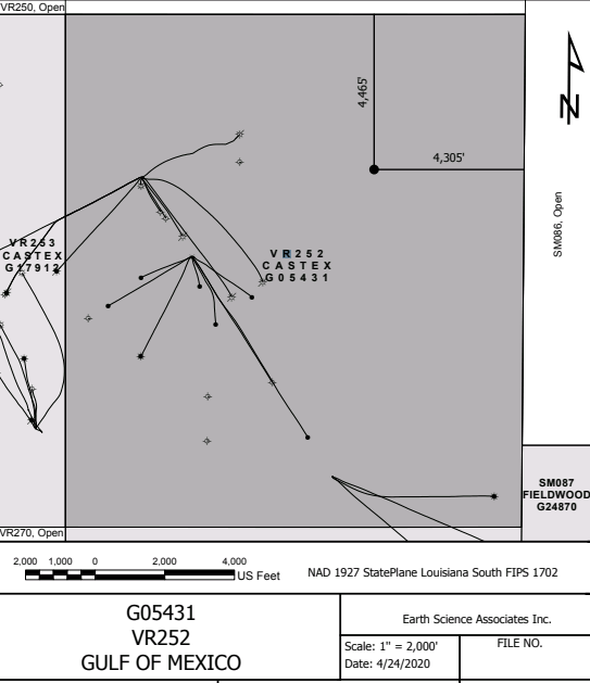
Plat Map
Overview
The Plat Map was designed to create a quick map of a block and show the location of a new well to submit a drilling application...
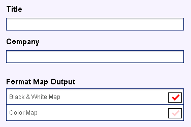
Header Information and Map Type
The first three input fields include a title, company and format for the map.
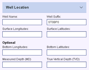
Well Location
These include optional fields to enter well location coordinates and depths.
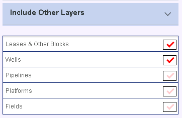
Other Layers in Map
The map can be customized by selecting from 5 different layers to be included.
Overview
The Plat Map was designed to create a quick map of a block and show the location of a new well to submit a drilling application to BOEM. The Plat Map can also be used to generate a quick map of wells, platforms, pipelines and field outlines within a block. The map is projected into the proper coordinate system for the area and downloaded as a PDF ready to print.
Header Information and Map Type
The first three input fields include a Title for the map (area block), name of the company for submission, and an option to create either colored or black and white map.
Well Location
The well location fields are all optional.
Well name with or without suffix
Coordinates for surface and bottom locations.
Measured Depth and True Vertical Depth values
Other Layers in Map
The map can be customized by selecting from 5 different layers to be included.
Lease and other blocks (labeled by Operator and OCS Number)
Wells (labeled by Well Name and Suffix)
Pipelines
Platforms
Field outlines