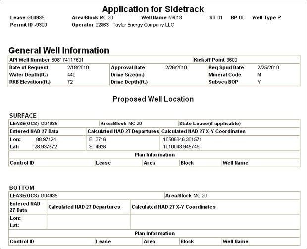
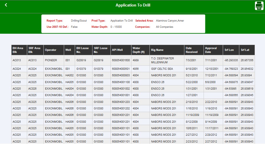
- API Number
- Operator Number
- Operator
- Bottom Area Code
- Bottom Block Number
- Bottom Lease Number
- District
- Date Application Received
- Surface N/S Distance
- Surface N/S Code
- Surface E/W Distance
- Surface E/W Code
- Surface Area Code
- Surface Block Number
- Surface Lease Number
- Well Name
- Well Suffix
- Water Depth (feet)
- Rig ID Number
- Rig Name
- Surface X Coordinate
- Surface Y Coordinate
- Surface Latitude
- Surface Longitude
- Approval Date
- Bottom Area Block*
- Surface Area Block*
- Bottom Area Block + Well Name*
- Surface Area Block + Well Name*
- Date Application Received
- Approval Date
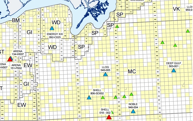
Maps
The newest Drilling Permit Application locations updated daily on the GOMsmart maps.