


WELLS & BOREHOLES
GOMsmart includes a full dataset on all boreholes from 1947. Automatically updated with MMS and ESA’s custom research. Easily access data on Well Production, Well Tests, Completions Intervals, Paleontology Reports and Well Logs.
View Wells & Boreholes
COMPLETIONS
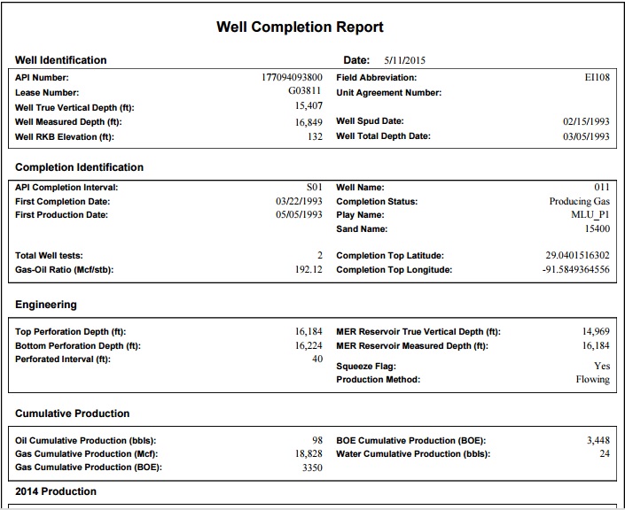
Completion data for all wells from 1947. Data includes Production, Tests, Sand-body reservoir, Perforations, and locations calculated from raw directional survey data.
View Completions
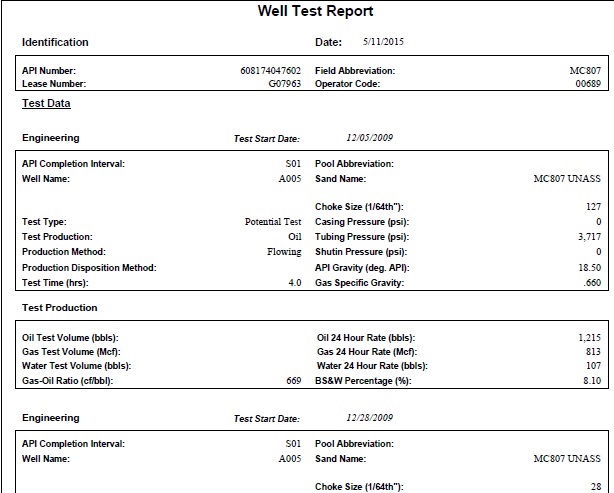
WELL TESTS
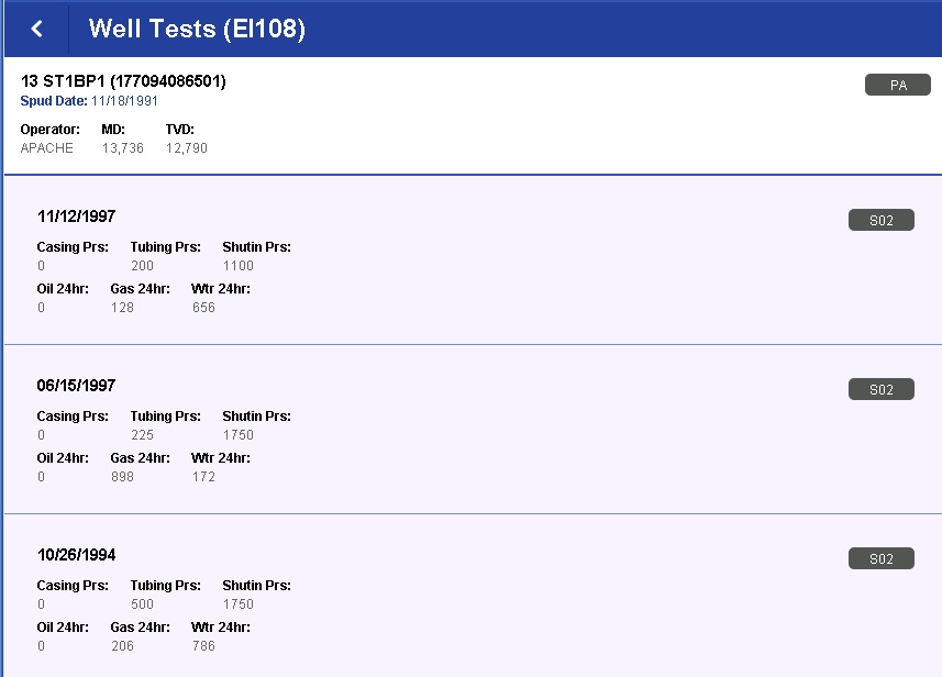
Data on Well Tests are accessed through Wells, Completions or as separate reports. Data include Pressure (tubing, casing, shutin), Flow Rates, Test Time and Perforation Intervals.
View Well Tests
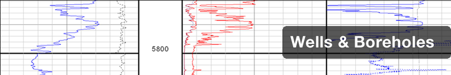
WELL LOGS
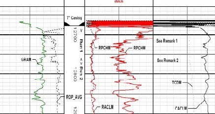
An extremely important data source for oil and gas production in the GOM, GOMsmart provides the complete collection of over 320,000 Well Log images and digital logs released by BOEM. Choose from all logs on a Well by type, with run dates and logged intervals.
View Well Logs
DIRECTIONAL SURVEY LINES
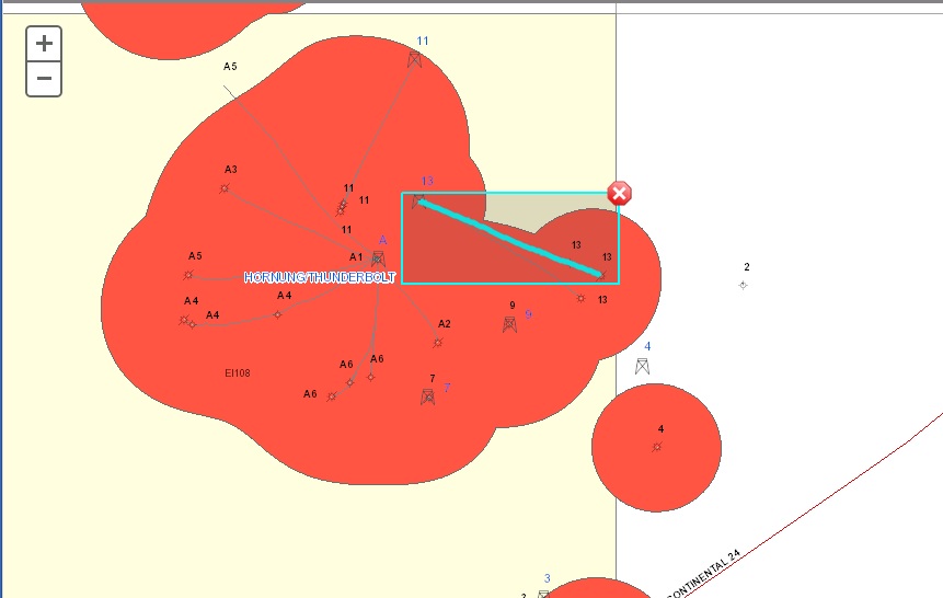
All raw Directional Survey Data released by MMS are processed by ESA and mapped as lines from the drilling location. The original Directional Survey data is also used to properly locate Completions and Paleo Observations.
View Directional Survey Lines