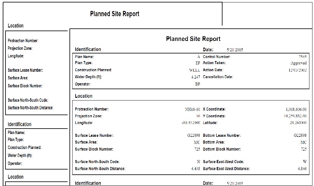
- Control Code
- Control Number
- Type
- Name
- Cancel Date
- Action Type
- Action Date
- Surface East-West Distance
- Surface East-West Code
- Surface North-South Distance
- Surface North-South Code
- Surface Area Code
- Surface Block Number
- Protraction Number
- Surface Lease Number
- Projection Zone Code
- X Coordinate
- Y Coordinate
- Latitude
- Longitude
- Bottom Lease Number
- Bottom Area Code
- Bottom Block Number
- Plan Type
- Water Depth (feet)
- Date Received
- Cancel Date
- Action Date
- Date Received
- Surface Area + Block Number*
- Bottom Area + Block Number*
- Operator Number
- Operator
- Plan Coordinator
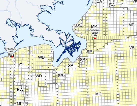
Maps
All planned wells/structures are mapped in GOMsmart. The newest planned sites are highlighted.