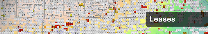
Leases
When you launch GOMsmart.com, you open to the main information page and have immediate access to Lease Data. All data related to each lease is available with a single click: Owners/Operators, Bids, Serial Remarks, Operating Rights, Units and Lease Descriptions. View and download customized maps. Create charts and reports for each individual or combination of Leases. Remember, with GOMsmart all Lease data is automatically updated whenever information is released, so you are always working with current information.
Data Updates
The Leases database is updated weekly.
Database
The GOMsmart Leases database includes data mined from BOEM and ESA’s own data research (*).
- Lease Number
- Serial Type
- Sale Number
- Expected Expiration Date
- API State/County Code
- Tract Number
- Lease Effective Date
- Primary Term
- Expiration Date
- Bid System Code
- Royalty Rate
- Original Surface Area
- Current Surface Area
- Rent per Unit
- Bid Amount
- Bid per Unit
- Block Minimum Water Depth (feet)
- Block Maximum Water Depth (feet)
- System Measure
- BOEM Planning Area
- District Code
- Status Abbreviation
- Status
- Status Effective Date
- Suspension Expiration Date
- Suspension Type
- Well Name
- Qualifying Well Type
- Qualifying Date
- Discovery Type
- Field Discovery Code
- Distance to Shore
- Number of Platforms
- First Platform Approval Date
- First Platform Installation Date
- Lease Section Type
- Postal/State Code
- Lease Section Area
- Protraction Number
- Suspension Effective Date
- First Production Date
- Area Code
- Block Number
- Area + Block Number*
- Expected Expiration Date
- Lease Effective Date
- Expiration Date
- Status Effective Date
- Suspension Expiration Date
- Qualify Date
- Platform Approval Date
- First Platform Date
- Suspension Effective Date
- First Production Date
- Number of Wells*
- Number of Producing Wells*
- Cumulative Oil Prod (bbls)*
- Cumulative Gas Prod (Mcf)*
- Cumulative Gas Prod (BOE)*
- Cumulative Water Prod (bbls)*
- Cumulative BOE Prod (BOE)*
- Oil Prod Last Calendar Year (bbls)*
- Gas Prod Last Calendar Year (Mcf)*
- Gas Prod Last Calendar Year (BOE)*
- Water Prod Last Calendar Year (bbls)*
- BOE Prod Last Calendar Year (BOE)*
- Number of Bids*
- Average Bid Amount*
- Winning Bid % of Average Bid*
- Money Left on Table*
- Second Highest Bid
- Percent of MLOT*
- Leases Available in Sale*
- Highest Bid of Sale*
- Operator Designation Date
- Operator Number
- Operator
- Operator Designation Date
- ESA Operator Sort Name
- Lease Expiration Year
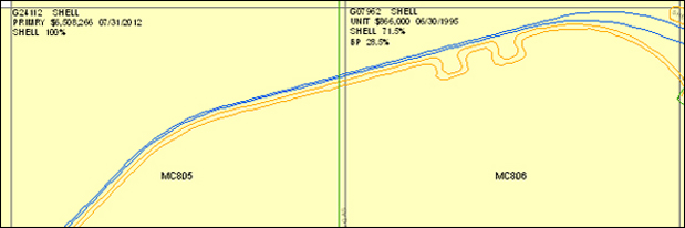
Maps
Leases are mapped with BOEM-supplied lease polygons. Leases in the GOMsmart map are labeled with the OCS Number, Operator, Status, Bonus, Effective Date, and each Owner and Assignment percentage.
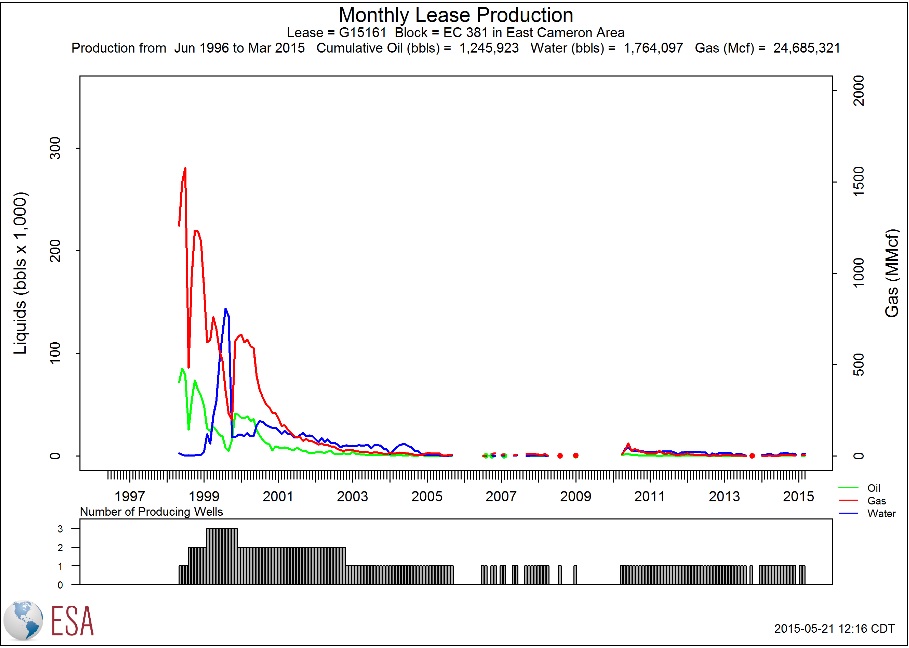
Charts
Single-Feature Charts:
There are 12 production charts available
for leases. Oil, gas, water and BOE data
are available annually or monthly. Charts
can be linear or logarithmic.
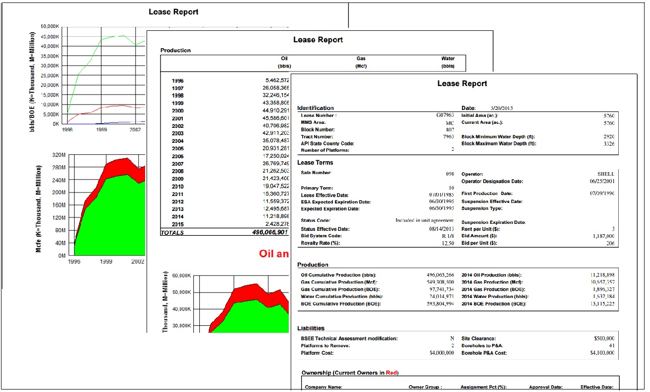
Reports
Single-Feature Reports:
There are 12 reports for leases.
- Summary Report (with Owner data)
- Bidding Report
- Remarks Report
- Production Data (as CSV file)
- Serial Register Page (BOEM Website)
- P/A Lease Liability (BOEM Website)
- Lease Owner Query (BOEM Website)
- Facility/Measurement Points (BOEM Website)
- Production Report (BOEM Website)
- Adjudication Documents (BOEM Website)
- SOP_SOO Documents (BOEM Website)
- Unit Documents (BOEM Website)
Multi-Feature Reports:
There are 10 reports when including the Operating Rights and Unit Allocations reports:
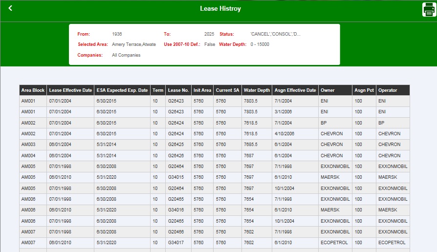
- Lease History
- Active Lease Ownership with Operator
- Active Lease Ownership With Net Production
- Expected Lease Expirations
- Undrilled Leases
- Company Ranking - Acreage
- Company Ranking - Ownership
- Operating Rights
- Open Acreage
- Unit Allocations